2nd Joint-US-GE-Cache „Reverse GPS“ (GC???)
You decided to copy my GPS cache. More information about the German version you can find here…
During the weekend I updated a lot of the sketch. Most difficult for me is to adapt the calculation of the compass angle. I’m still not convinced, it’s working now.
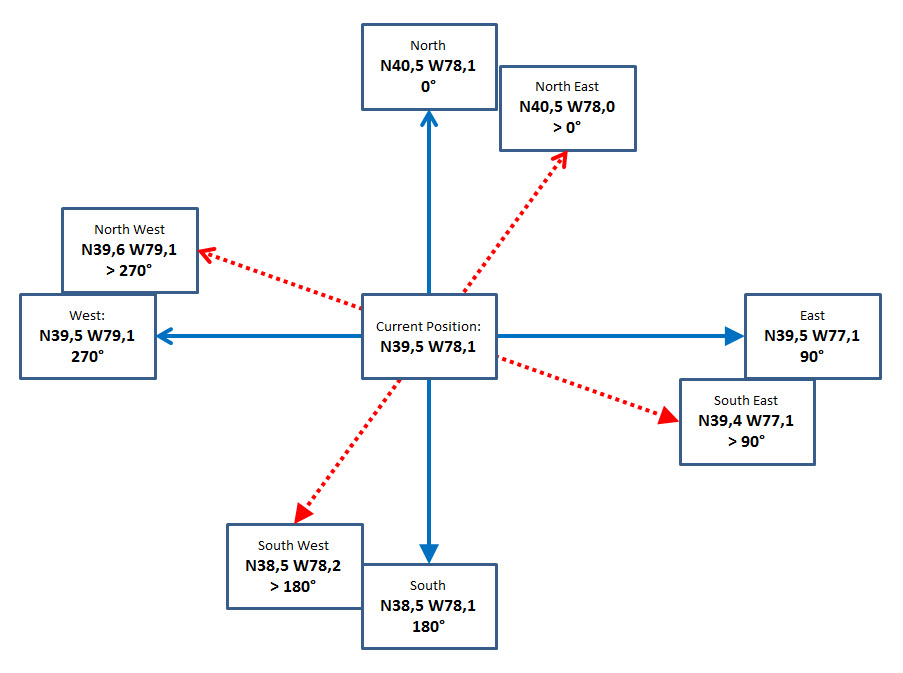
using „normal“ trigonometric functions, the angle being calculated is between -90° and +90°, while a compass is showing 0° (or 360°) for North, 90° for East, 180° for South and 270° for West. Unfortunately the value of the longitude is increasing in Germany when going East, it’s increasing in the States when going West. So I made a drawing to think about:
The sketch is like this and you, Tim, must still check, if it’s running well (for East cordinates it’s fine already):

We had a FaceTime chat on Friday (as planned) and a spontaneous one on Saturday when something was running bad on your side. I enjoyed them both!
Here’s already a draft of the certificate:

Status (4.11.2015):
We’re still fighting with the sketch. Main problem is the calculation of the compass angle. It’s working here in Germany but it doesn’t in the States. But we’re coming closer and closer…
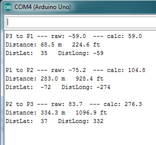
I’ve built a new sketch for testing only and examined the „true“ values from Garmin BaseCamp (from now on I’m owning a „free of charge“ topographic map of WV used BaseCamp:
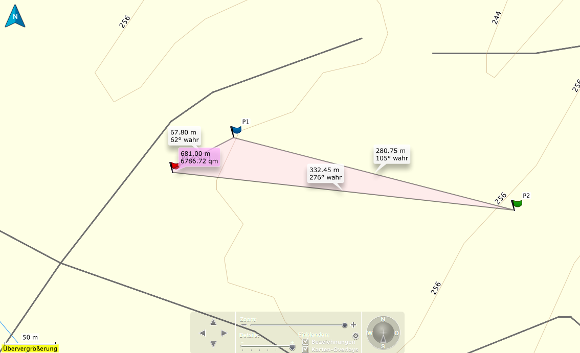
With the test sketch it’s running quite fine. In Germany! In the US too?
I guess, it will still take some time to say, this one is ready too…
Learning by building geocaches … or „negative coordinates“ (5.11.2015):
During the last 24 hours I’ve learned a lot. At least about coordinates sent from the GPS satellites.
By what? By geocaching!. What I needed for learning:
- a problem with the GPS coordniates displayed from the cache
- you as a friend in the States
What happened?
Above you already read a lot about my problems to calculate the compass angle. Here in Europe everything worked fine, but in the States I had great problems. I was working on a separate calculation for the West area, where when you’re going east the W-value of the longitude is decreasing, while the E-value is increasing here in Europe.
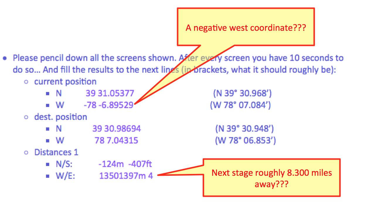
When I nearly fixed the topic with the angle, the distance was wrong. Thousands of miles to go have been displayed when it should be less than 100 feet. Some days I worked on that without solving. So I included a lot of lines for control output into the sketch and asked you to pencil down and tell me, what was shown on the LCD. You did so and I saw a negative value coming from the GPS break out for the longitude at your current location. A negative longitude??? But on that value I made no calculation. I just sent it to the LCD. Nothing more. But this eMail started learning:
And that was the solution as result of learning (and thinking)!
But in reality the GPS signals doesn’t contain any letters like „N“ for North or „W“ for West. But the signals can be positive or negative: So a longitude of 10° is displayed as E10° while -10° is displayed as W10°.
But it’s like this:
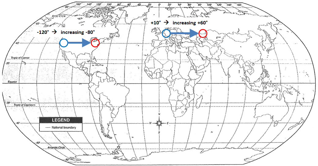
Do you see now two times „increasing“ above? That has a big impact to the calculation of the compass angle. It’s not different in the States! It’s like in Europe: Going east in the States is also an increase of the coordinates: Eg. from W120° to W80° is in reality an increase from -120° to -80° (because -80 is for sure greater than -120). So my calculation is working everywhere!!! Even in down under:
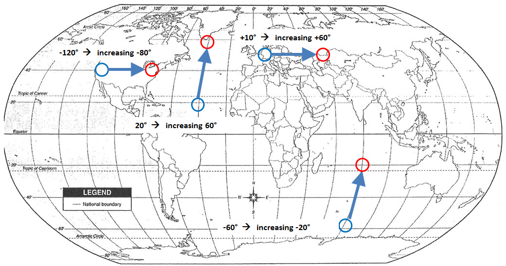
Because going North in down under means to go from S60° to S20° and this is from -60° to -20°. And again -20 is greater than -60…
I’ve updated the sketch again and hope, by including my new calculations (from a test sketch) into it and using some new subroutines isn’t mixing everything up again…
Sunday, 8.11.2015
It seems to be nearly perfect now. Only a little bug in the part where the coordinates to the next station are shown. On a first view it should work. Because it doesn’t, that view was wrong. Hard to test without hardware, but I’ll do so, when being back home. I’ll include some test output and will display it on the serial monitor…
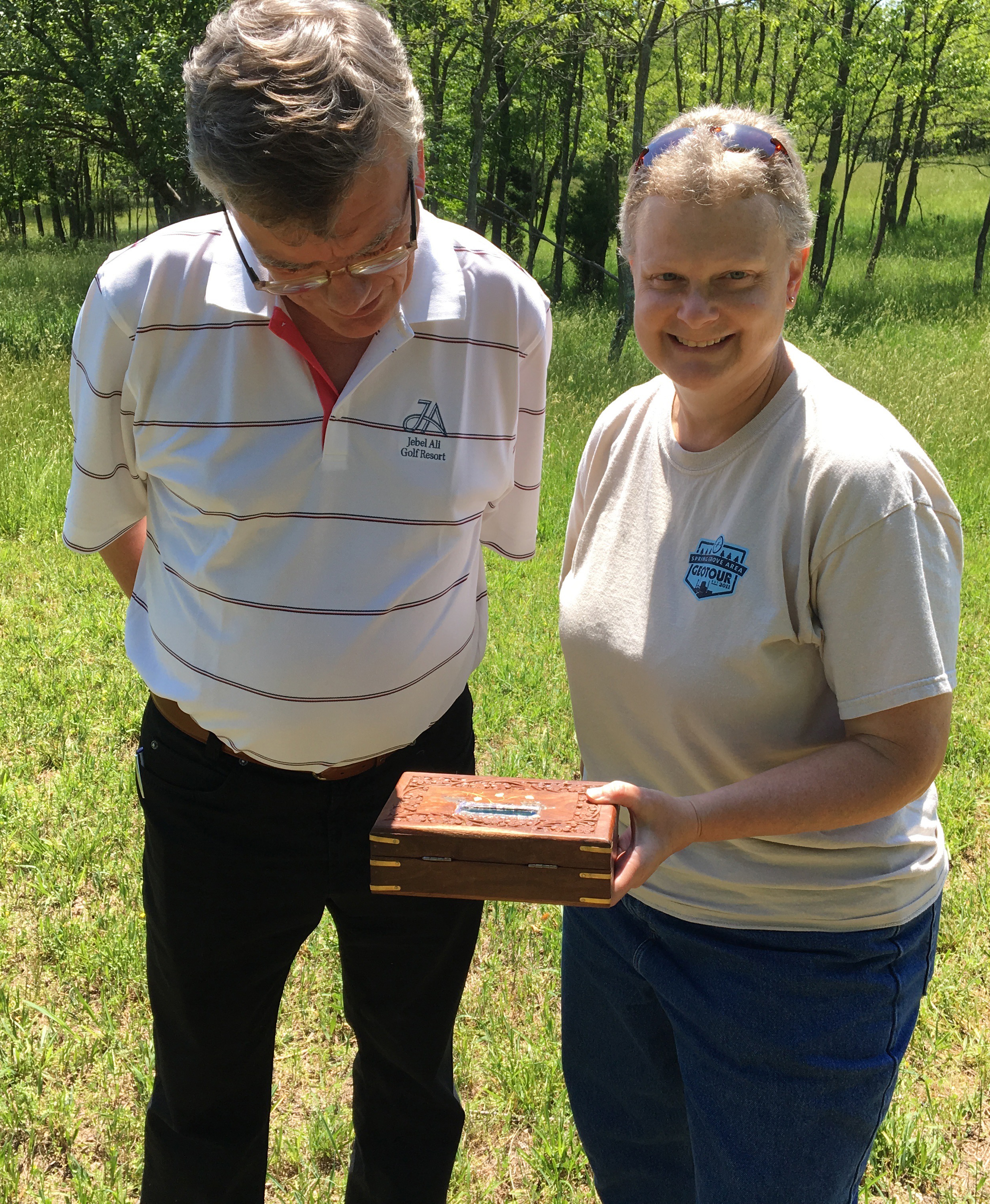
And here’s a picture showing an American geocacher and me when I stood for a week with Tim and Marsha:
You can pick the full sketch here…